top of page
Drone Surveying, Mapping, and Inspection Services Blog


What Is RGB Imagery in Drone Mapping and How Is It Used?
Drone mapping utilizes RGB imagery more than any other data type. The combination of its simplicity and cost-effectiveness makes it the backbone of many types of workflows that include aerial surveying, mapping, and inspecting in various fields, including construction , agriculture , real estate , mining , and urban planning. RGB Imagery in Drone Mapping What Is RGB Imagery? RGB Imagery is a type of photograph that is created from light in red, green, and blue. These three co
Dec 15, 20254 min read


The Future of Drone Data Storage: Cloud Workflows, Metadata & Big Data Management
As the use of drones in mapping with aerial photography and LiDAR becomes more commonplace, new opportunities have arisen to do so with high volumes of data; however, there is also a need to have methods to manage, organize, and transmit this large amount of data from drones efficiently through sharing and long-term storage or archival methods. This blog discusses new ways that modern-day processing options, such as cloud storage, various forms of metadata, and big data mana
Dec 9, 20256 min read


How to Plan Legal and Safe Drone Missions in the U.S. (FAA + State Regulations Guide)
Drones affect changes across a wide range of industries, including Aerial Photography , Agriculture , Infrastructure Inspection, and Drone Response to Emergencies. Flying a Drone safely requires knowledge of the controls and an understanding of the Federal and State Laws that apply to Drone Operations in the United States. The Federal Aviation Administration (FAA) sets forth the rules for Operating Drones in the United States. In addition to FAA Rules, some states have other
Dec 2, 20254 min read


LiDAR vs RADAR for Drones: Which Technology is Best for Your UAV?
In the fast-paced development of UAVs, choosing the right sensing technology is pivotal for mission success. LiDAR and RADAR are two of the leading technologies that are being used in drones for navigation, mapping, and obstacle detection. For which one is the best choice for your UAV? Let's break it down: LiDAR vs RADAR for Drones (Created by Google Gemini) What is LiDAR? LiDAR stands for Light Detection and Ranging , a remote sensing technology that uses laser pulses to mea
Nov 20, 20252 min read


How Do LiDARs Work: A Technical Guide Explained
LiDAR technology is quickly becoming the backbone of modern mapping, autonomous vehicles, robotics, and geospatial analytics. But how exactly does LiDAR work, and what makes it so precise and strong? This technical paper describes LiDAR mechanics, applications, and technical functionality. LiDAR Technologies What is LiDAR? LiDAR, or Light Detection and Ranging , is a remotely-sensed technology that detects distance to a target using laser light. The system emits laser pulses
Oct 14, 20253 min read


Exploring Drone Applications in Modern Technology
In the past few years, drones have gone from being specialty gadgets to crucial tools in a variety of industries. With fast advancements...
Oct 9, 20253 min read


Singapore Drone Pilots: Skills, Licenses & Tech Tips
Drones have moved beyond toys to robust platforms for photography, surveying, agriculture, and industrial inspections. Singapore is...
Oct 8, 20253 min read


Precision Topographic Mapping Using Drones
With the ongoing shift to digital, the days of traditional surveying for precision topographic mapping are in the past. Drones, or UAVs,...
Sep 24, 20253 min read


Drone Operations in France: Everything You Need
Drones are now far more than just toys; they are becoming increasingly integral in several industries - agriculture , surveying,...
Sep 23, 20253 min read


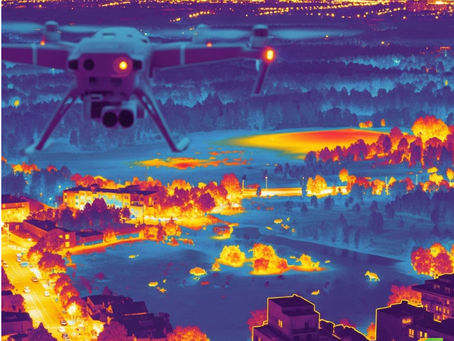
Drone Thermal Imaging for Inspections
Drone thermal imaging has revolutionized the way industries do inspections in recent years. Businesses are able to identify heat...
Sep 4, 20252 min read


What is the highest resolution drone imagery available?
The Ground Sample Distance (GSD) of the best resolution drone imaging ranges from 1 to 5 centimetres per pixel. This enables incredibly...
Aug 18, 20252 min read


How to Create a Digital Surface Model (DSM) Using Drone Imagery: A Step-by-Step Guide
Generating a Digital Surface Model (DSM) from drone imagery is an essential process in contemporary geospatial analysis, agriculture ,...
May 14, 20252 min read


Beginner’s Guide to KML Files: What They Are and How to Build One
If you’re exploring custom maps or dealing with geographic data , you may have encountered KML files. These files are crucial for...
May 13, 20252 min read


Understanding the Difference Between KML and KMZ File Formats
When working with geographic data in applications such as Google Earth or GIS, you will frequently encounter file formats like KML and...
May 13, 20253 min read


Contour Maps Explained: Uses, Types, and Key Features
Contour maps are essential tools in geography, engineering, and environmental sciences. They provide a detailed and accurate...
May 12, 20252 min read


What Is a Drone Aerial Survey? Key Benefits and Use Cases
In today's fast-paced, data-driven world, drone technology is transforming how we capture and analyse geographic information. One...
Apr 24, 20253 min read


Drone Imagery 101: A Beginner’s Guide to Aerial Photography
In recent years, drones have revolutionized how we capture the world around us. Whether you're mapping landscapes, surveying construction...
Apr 15, 20252 min read


What Is the Highest Resolution Drone Imagery Available Today?
In the fast-paced world of drone technology, high-resolution aerial imagery has become a game-changer for industries ranging from...
Apr 15, 20252 min read
bottom of page
