
Drone Thermal Imaging for Inspections
- Anvita Shrivastava

- Sep 4, 2025
- 2 min read
Drone thermal imaging has revolutionized the way industries do inspections in recent years. Businesses are able to identify heat signatures that are not apparent to the human eye by combining infrared cameras with UAVs. In industries including public safety, construction, energy, and agriculture, this technology makes inspections quicker, safer, and more affordable.
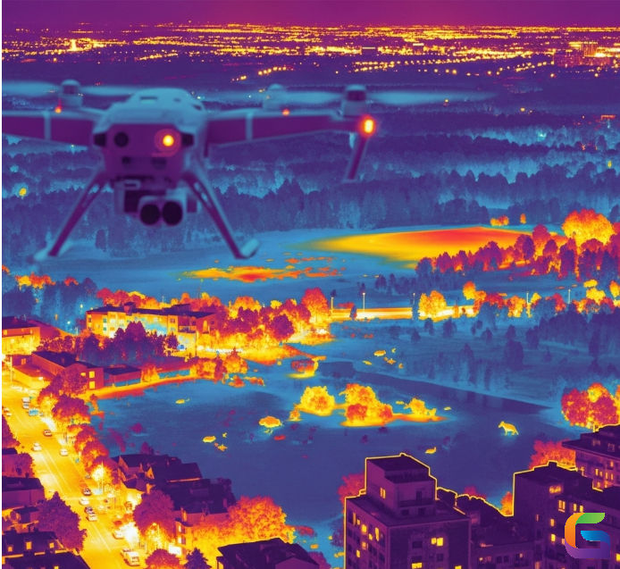
What Is Drone Thermal Imaging?
Infrared sensors are used in drone thermal imaging to monitor surface temperatures and create heat maps. Anomalies like heat leaks, broken equipment, or structural flaws are shown in these photos. Thermal sensors are perfect for crucial inspections since, in contrast to conventional optical cameras, they can identify problems even in dimly lit areas, smoke-filled areas, and inclement weather.
Principal Advantages of Thermal Drone Inspections
Increased Safety: Workers no longer have to scale towers, scaffolding, or dangerous locations thanks to drones.
Cost-effectiveness: Compared to traditional inspections, faster surveys save labor expenses and downtime.
High Accuracy: Thermal cameras identify problems early on, averting expensive malfunctions.
Broad Coverage: In a fraction of the time, UAVs can cover vast and challenging-to-reach locations.
Real-Time Data: Inspectors can make decisions more quickly by using instant thermal information.
Industries Using Drone Thermal Imaging
Energy & Utilities: Checking solar panels, substations, and power cables for faults or overheating.
Construction: Identifying building HVAC problems, moisture intrusion, and insulation leaks.
Oil and gas: keeping an eye on storage tanks and pipelines to avoid leaks and explosions.
Agriculture: Using thermal signatures to assess crop health and irrigation effectiveness.
Public safety includes catastrophe response, search and rescue, and firefighting.
How Thermal Drone Inspections Work
Flight Planning: Using GPS-based mapping software, operators specify inspection routes.
Thermal Data Capture: Temperature changes are captured by the drone's infrared camera.
Data analysis: Images are transformed into intricate heat maps using specialized software.
Reporting: To take corrective action, engineers or managers are informed of the results.
Choosing the Right Drone Thermal Camera
Take into account the following while choosing a drone for thermal inspections:
Resolution (detailed heat maps are guaranteed by a greater pixel count)
Sensitivity (capacity to identify minute variations in temperature)
Integration (ability to work with GIS or mapping software)
Flight Duration (extended endurance for extensive examinations)
The Future of Drone Thermal Imaging
Drones will be able to automatically detect flaws in real time, in addition to collecting thermal data, thanks to developments in AI and machine learning. This will lower hazards in all industries and significantly streamline predictive maintenance.
The use of drone thermal imaging for inspections is transforming how companies keep an eye on their infrastructure and assets. UAV-based thermal inspections are becoming a vital component of contemporary industrial operations, offering precise data and lowering operating hazards. Organizations that embrace the technology early on will undoubtedly benefit from increased efficiency, safety, and cost savings as it develops further.
For more information or any questions regarding drone thermal imaging, please don't hesitate to contact us at:
Email: info@geowgs84.com
USA (HQ): (720) 702–4849


Comments