
Precision Topographic Mapping Using Drones
- Anvita Shrivastava

- Sep 24, 2025
- 3 min read
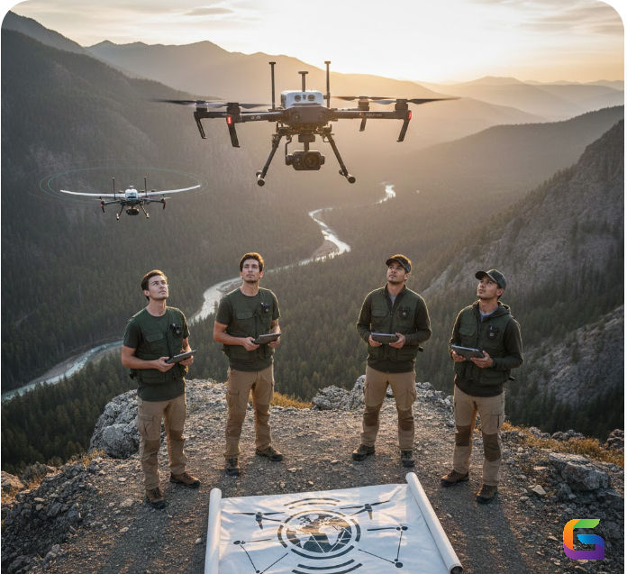
With the ongoing shift to digital, the days of traditional surveying for precision topographic mapping are in the past. Drones, or UAVs, are changing the way we capture highly accurate geospatial data and affecting civil engineering, construction, agriculture, environmental management, and many other related industries. This blog post will explain how drones are transforming topographic mapping, their technological advances, and why they are becoming an essential part of the toolbox for geospatial professionals.

What is Precision Topographic Mapping?
Topographic mapping refers to the representation of features of the Earth’s surface, including elevation, relief, and natural and built features, on a map that is informative and intricate. Conventional topographic mapping is still primarily based on mappable elevation using ground-based survey methods, such as Total Stations, which can be time-consuming, labor-intensive, and limited based on the accessibility of the terrain.
High-resolution data acquisition methods are applied to complete precision topographic mapping, resulting in accurate Digital Elevation Models (DEMs), contour maps, and three-dimensional (3D) terrain models. With the advent of drone technologies, LiDAR sensors, and photogrammetry software, mapping at centimeter-level accuracy is possible today.
How Drones Transform Topographic Mapping
Drones are changing the surveying process in three ways:
High Definition Data Capture
Modern drones equipped with RGB cameras, multispectral sensors, and LiDAR scanners can collect very complete data on terrain features. Operating at low altitudes provides high spatial resolution and accuracy in elevation data in a fraction of the time compared to traditional methods.
Fast Surveying of Large Areas
Drones can survey a simple site with hundreds of acres in hours (vs. by hand). This would be helpful for large commercial sites, mine sites, and agricultural stubble. Drone flight planning software can automatically plan a flight, ensuring complete coverage and limiting human error.
3D Representation and Structuring
Drones create precise 3D point clouds and digital terrain models (DTMs) using photogrammetry and LiDAR data. These models facilitate accurate examination of slope, elevation, and surface irregularities, assisting in engineering design and land management.
Safe and economical
Drones significantly reduce costs and enhance worker safety by minimizing the requirement for manual labor in challenging environments like mountains, forests, or dangerous construction areas.
Key Technologies Behind Drone-Based Topographic Mapping
Photogrammetry
Photogrammetry transforms overlapping aerial photographs into 3D spatial information. Current software packages will stitch together numerous drone photographs into orthomosaic maps or contour models with centimeter-level accuracy.
LiDAR (Light Detection and Ranging)
LiDAR sensors will send laser pulses to measure the distance to the surface of the earth. Unlike photogrammetry, vertical surfaces using LiDAR will measure ground elevation, which enables vegetation penetration and is ideal for measuring wooded or uneven surfaces.
GNSS/RTK Integration
Combining Global Navigation Satellite Systems (GNSS) with Real-Time Kinematic (RTK) technology provides high positional accuracy, even within 2-5 centimeters. This is vital for engineering projects and any type of cadastral mapping.
Challenges and Considerations
Despite the many benefits of drones, professionals need to confront three complications:
Regulations: UAVs must comply with local aviation regulations and their operational limitations.
Weather-dependent: Wind, rain, and low visibility may impact the quality of your data.
Processing data: When working with large datasets, you must employ appropriate processing tools and software.
Addressing these complications allows organizations to take full advantage of the accuracy and efficiency of drone-based topographic mapping.
Future of Drone Mapping
The integration of AI-powered analytics, cloud computing, and autonomous UAVs will increase the speed of precise topographic mapping, improve accuracy, and provide greater intelligence. Soon, real-time terrain monitoring, predictive modeling, and connectivity to GIS and BIM platforms will be established procedures.
Precision topographic mapping with drones is no longer a vision of the future. Drone technology is now a viable solution for modern surveying and geospatial analysis that is affordable, accurate, and accessible. Drones are enabling different professionals in a range of fields - from construction to environmental management - to make better decisions, faster decisions, and safer decisions.
Implementing drone-based mapping technology in the present time guarantees your projects keep pace with precision, efficiency, and innovation.
For more information or any questions regarding drone topographic mapping, please don't hesitate to contact us at:
Email: info@geowgs84.com
USA (HQ): (720) 702–4849


Comments