
What Is a GIS Datum? Geographic and Geodetic Datums Explained

An accurate geographic information system (GIS) depends on precise spatial data for the mapping of locations, geospatial analysis, and integration of data sets. One of the basic concepts used in achieving geospatial analysis accuracy is the use of a GIS datum. A datum serves as a framework that gives definitions to the position of locations on the Earth's surface so that the GIS software, surveying equipment, and remote sensing technology can define the geographic coordinates precisely.
A geographic datum and geodetic datum are vital in satellite image processing, GPS navigation, land surveys, topographic maps, and coordinate reference systems (CRSs). An inaccurate use of the datum will cause the geographic coordinates to be wrongly positioned.
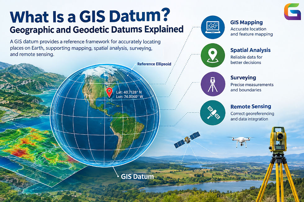
What Is a GIS Datum?
GIS datum is a mathematical reference system that helps to describe the size, shape, orientation, and position of the Earth. In addition, the datum sets a reference system for calculating coordinates, thus helping GIS software locate points, lines, polygons, and rasters.
Since the Earth is not perfectly spherical, there is a need for a mathematical model that would help to represent the Earth's surface. The most commonly used geodetic systems use an ellipsoid to represent the Earth. The datum describes how the ellipsoid corresponds to the Earth.
The datum is needed by GIS software to interpret coordinates like latitude, longitude, and elevation. The coordinates of a point on the surface might be interpreted differently in terms of other datums.
Datums in GIS technology can be used for:
Georeferencing satellite and aerial images
Positioning with GPS and GNSS
Land surveying and cadastre mapping
Mapping transportation networks and infrastructures
Environmental monitoring and land use studies
Coordinate conversion in geographic information.
It is important to select the proper datum when dealing with geographic information collected through various means.
What Is a Geographic Datum?
A geographic datum defines a reference system that can be used for representing the position of a point on the Earth's surface in terms of geographic coordinates such as latitude and longitude.
Latitude represents the angular distance between the point and the equator, while longitude represents the angular distance between the point and the prime meridian. The coordinates of the point are based on the reference system in use.
A geographic datum provides a way of relating the reference ellipsoid to the Earth's surface. The relationship depends on whether the reference system in use is local or geocentric.
Some of the geodetic reference systems that have been developed are the North American Datum of 1983 (NAD83) and World Geodetic System 1984 (WGS 84).
Geographic datums are essential when integrating GPS coordinates, remote sensing, vector data sets, and administrative boundaries in GIS applications.
What Is a Geodetic Datum?
A geodetic datum is a reference system utilized for determining the locations of objects on or above the surface of the Earth by establishing the connection between a mathematical representation of the Earth and a coordinate system.
Geodetic datums allow performing accurate measurements of horizontal, vertical, and three-dimensional positions of objects. These datums form the basis for geodesy – a science that deals with the study of the geometry of the Earth and its gravity field.
The modern geodetic reference frames may consider the rotation of the Earth, motions of tectonic plates, and time-dependence of coordinates. These features play a crucial role in high-precision GNSS positioning, scientific observations, and engineering surveys.
Geodetic datums may include the following characteristics:
Reference ellipsoid – a geometrical model of the Earth.
Origin – a reference point or coordinate origin.
Orientation – the orientation of coordinate axes relative to the Earth.
Scale – the proportionality between coordinate units and real distances.
Reference epoch – the date of the coordinates in a time-dependent reference frame.
Geodetic datums are used in surveying, geospatial data processing, mapping, and satellite navigation.
Geographic Datum vs. Geodetic Datum
The terms geographic datum and geodetic datum are often used interchangeably in GIS documentation. Both describe reference frameworks used to determine geographic positions. However, the terminology can vary according to the software, standard, or technical context.
Feature | Geographic Datum | Geodetic Datum |
Primary purpose | Supports geographic positioning using latitude and longitude | Establishes a reference framework for precise Earth measurements |
Reference model | Uses a defined reference surface, typically an ellipsoid | Defines the relationship between the reference model and the Earth |
Coordinate dimensions | Commonly associated with horizontal geographic coordinates | Can support horizontal, vertical, and 3D positioning |
Typical applications | GIS mapping, imagery alignment, geographic data exchange | Surveying, GNSS, geodesy, and high-precision positioning |
Time dependence | Depends on the specific reference system | May explicitly account for time-dependent coordinate changes |
The distinction is not absolute: a geographic datum is generally a type of geodetic reference framework. When selecting a datum, it is more important to identify the specific reference system and its parameters than to rely on terminology alone.
Types of GIS Datums
Different types of GIS datums are employed in various GIS applications in relation to their application and dimension.
Horizontal Datum
A horizontal datum is referred to as the reference system for horizontal positioning of points on the Earth's surface. It is applied in conjunction with either latitude and longitude or projected coordinate systems.
Examples of horizontal datums include WGS 84 and NAD83.
It is significant in the mapping of roads, property boundaries, satellite imagery, utilities, and other geographic features.
Vertical Datum
The vertical datum is a reference for heights or depths. Contrary to horizontal positioning, which refers to the positioning of points on the Earth's surface, the vertical position refers to the height or depth of the point in relation to the reference plane.
It could be derived from the average sea level, the designated tidal datum, or the geodetic reference surface.
Examples include orthometric height that is in relation to the geoid, and ellipsoidal height in relation to the reference ellipsoid.
They are not convertible without a suitable model.
Geocentric Datum
A geocentric datum makes use of an origin linked with the center of mass of the Earth. This is ideal for global positioning and satellite positioning.
The WGS 84 is an example of a geocentric datum that is used in GPS and global mapping applications.
Geocentric coordinate reference systems allow accurate global positioning, although precision requires consideration of realization and reference epoch.
Local or Regional Datum
A local or regional datum is designed in such a way that there will be a good fit on the surface of the Earth in a certain region. The ellipsoid of this datum can be placed in such a way that errors are reduced in the area.
Examples of a local or regional datum include NAD27 and ED50.
A local datum can be suitable in case of historic maps and datasets, but the coordinates must be transformed to match the modern global positioning system.
How to Determine the Datum of a GIS
Determination of the datum of a spatial dataset is an essential preliminary step for GIS analysis. There are different ways to find out the datum depending on file format and GIS software.
In QGIS
Launch QGIS and load the dataset into it.
Right-click on the layer and go to Properties.
Choose either the Information tab or the Source tab, depending on the version of QGIS.
Look at the coordinate reference system (CRS) information.
Pay attention to the authority name, datum, units of coordinates, and other projection information.
The CRS of the project and the CRS of the layer may be different, as QGIS can transform data while displaying it. Make sure you know the CRS of your layer.
In ArcGIS Pro
Add the dataset to your map.
Go to the Properties of the layer.
Find the Source tab.
Look at the spatial reference information there.
There will be information about the geographic coordinate system, datum, projected coordinate system, and units.
If there are several layers, check their spatial references and transformations in the map.
Using GDAL
The GDAL command-line tool can analyze the spatial reference information linked to various raster and vector data types.
To analyze the spatial reference information of a raster file, use:
gdalinfo satellite_image.tif
To analyze the spatial reference information of a vector file, use:
ogrinfo -al -so roads.shp
Check the information of the coordinate reference system, including the datum, coordinate system, and projection information. Some datasets do not have complete information about their coordinate reference system.
GDAL can also provide more in-depth analysis of the coordinate reference system by providing CRS definitions in WKT format, among others.
The datum is one of the key references used in defining geographic locations. Geodetic and geographic datums are used for location representations on Earth, whereas coordinate systems and map projections are responsible for how locations are represented on a map.
The knowledge of differences between such reference systems as WGS 84, NAD83, NAD27, ED50, and others is essential for effective management of spatial data by GIS practitioners. The correct definition of the reference system and its proper use become especially important when using satellite images, drone maps, LiDAR point clouds, digital elevation models, and surveying data.
Proper selection of references and their application can be helpful in reducing positional errors.
For more information or any questions regarding GIS Datum, please don't hesitate to contact us at:
Email:
USA (HQ): (720) 702–4849


Comments