
Understanding Coordinate Systems in GIS: A Beginner’s Guide

Geographic Information Systems (GIS) use proper spatial data in order to map objects, conduct geographic analysis, and support decision-making. A coordinate system is one of the basic elements in Geographic Information Systems (GIS), which represents the method by which objects on the Earth's surface are referenced numerically. In case of absence of an appropriate coordinate system, spatial data sets can look misaligned, calculations of distances will be inaccurate and, therefore, geographic analyses might give wrong conclusions.
The knowledge of coordinate systems is useful in such spheres as cartography, surveying, remote sensing, urban planning, environmental monitoring, transport, and satellite image analysis.

What Is a Coordinate System in GIS?
A coordinate system in GIS refers to a mathematical tool utilized to specify the geographical position of features on the Earth's surface. The coordinate system is what enables GIS software to locate the numerical values of features.
For example, the coordinate pair could describe the position of a particular building, road junction, river, or pixel on a satellite image. But the interpretation of the values is dependent on the coordinate system applied.
In case a location is specified using latitude and longitude, then angular units are used, whereas in a projected coordinate system, a location is specified using linear units such as meters and feet.
There are two main types of GIS coordinate systems:
Geographic Coordinate System (GCS): The location of the feature is represented using latitude and longitude on a curved reference surface.
Projected Coordinate System (PCS): Locations on a flat two-dimensional plane map are represented through map projection.
Why Are Coordinate Systems Important in GIS?
Coordinate systems provide a standard spatial reference system for geographical data. If different coordinate systems are employed in datasets, GIS will have to convert the coordinates before overlaying them for analysis purposes.
This is important in several GIS processes:
Accurate Location Identification
The location of places on Earth can be determined using coordinate systems. Geographical coordinates are commonly used in GPS mapping and geocoding.
Distance and Area Measurement
Projected coordinate systems allow for proper calculation of distances and areas, provided that there is a correct projection and unit. The calculations will not be precise if there is an incorrect projection.
Spatial Data Integration
GIS projects always require integration of satellite images, drone images, digital elevation models (DEMs), vector data, and field data.
Map Production
The choice of coordinate systems is determined by the geographical extent, scale of the map, and the use of the map itself. The projection that is acceptable for an engineering survey in one region may not be appropriate for the whole Earth.
Remote Sensing and Geospatial Analysis
Georeferencing is crucial for satellite images, orthoimages, elevation data, etc., for proper overlay, terrain analysis, change detection, and feature extraction.
Types of Coordinate Systems in GIS
Knowing how a geographic coordinate system differs from a projected one is the starting point for effectively handling spatial data.
Geographic Coordinate System (GCS)
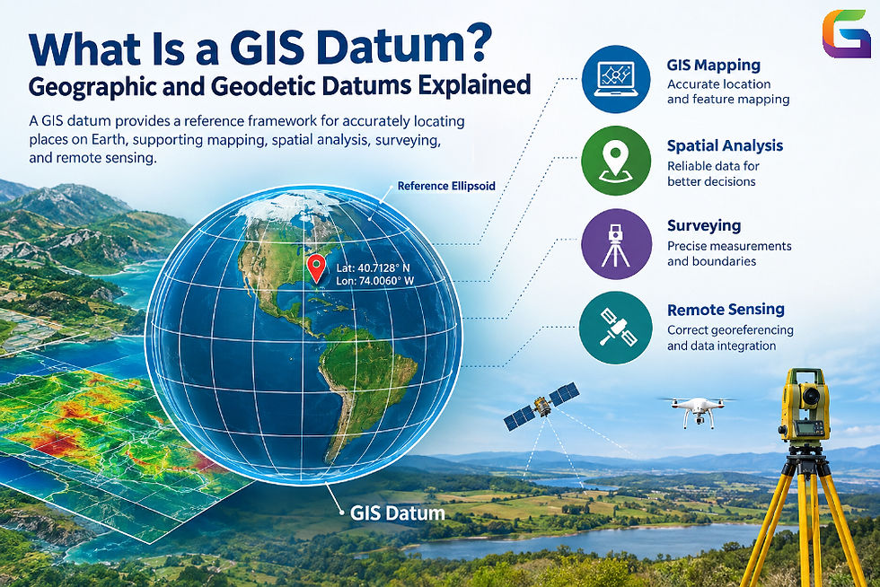
Geographic Coordinate System uses angles to locate points, mostly latitude and longitude. Coordinates are based on a datum and a reference ellipsoid.
Latitude is the angle measuring distance north and south of the Equator and varies between 90°S and 90°N.
Longitude is the angle measuring distance east and west of the prime meridian and usually ranges from 180°W to 180°E.
For example, a point can have these coordinates:
Latitude: 40.7128°N
Longitude: 74.0060°W
These coordinates will define a location somewhere in New York City.
Geographic coordinates are normally expressed in decimal degrees or degrees-minutes-seconds (DMS). Decimal degree coordinates are commonly used in GIS software, GPS, web maps, and geospatial applications.
Some popular geographic coordinate systems are:
WGS 84 (World Geodetic System 1984)
NAD83 (North American Datum 1983)
GDA2020 (Geocentric Datum of Australia 2020)
Coordinate values alone do not completely describe a location. The datum and the coordinate reference system must also be known.
Projected Coordinate System (PCS)
Projected Coordinate Systems are used to represent locations on a curved Earth reference surface on a flat plane based on a particular map projection mathematically.
Projected coordinates are usually in linear measurement units like meters or feet and usually refer to easting and northing.
Easting: It is the horizontal axis that increases eastwards.
Northing: It is the vertical axis that increases northwards.
For example, an easting of 500,000 meters and northing of 4,500,000 meters are projected coordinates which are only meaningful within a specific projected coordinate system. They must be interpreted with respect to the correct projected coordinate system together with its projection parameters, datum, and units.
Projected coordinate systems are important for applications in engineering, land surveying, cadastral mapping, infrastructure planning, and regional analysis.
Some popular examples are:
Universal Transverse Mercator (UTM)
State Plane Coordinate System
Web Mercator (most common in web maps)
Each map projection brings in distortion since it cannot bring a curved surface to a flat plane without distorting one or more geometric properties.
How to Choose the Right Coordinate System
Choosing the right coordinate system will depend on the specific needs of the GIS project.
Consider the Geographic Extent
If you are dealing with global data, a geographic CRS like WGS 84 could be adequate for storing and exchanging coordinates. If your project is regional, a local or regional projected CRS might give you better measurement properties.
Identify the Analysis Requirements
If your project includes distance calculations, areas, buffers, or engineering calculations, pick a CRS that will work well for those tasks. Equal-area projections help compare areas, whereas suitable conformal projections might be used if necessary.
Check Data Compatibility
Make sure that the CRS of each input dataset matches before joining your layers together. Different coordinate systems can be viewed together through on-the-fly transformation, although analysis will still require the correct CRS definitions and transformations.
Review Accuracy Requirements
Surveying, cadastral surveying, and precision engineering might need a particular local CRS along with an appropriate datum transformation. The web mapping projection that is generally applicable might not be able to give the required accuracy of measurements.
Verify Coordinate Units and Identifiers
It is important to validate the coordinate units (meters, feet, degrees) and CRS identifiers. One cannot assume that all coordinate datasets containing the same numerical value of coordinates represent the same geographic location.
Working With Coordinate Systems in GIS Software
Popular GIS software packages have the capability of analyzing, setting, and changing coordinate systems.
QGIS
In QGIS, it is possible for the user to analyze the CRS of the project and the individual layers of the dataset. The properties and export options enable the user to analyze and change CRS definitions and project datasets.
ArcGIS Pro
ArcGIS Pro enables the user to set the coordinate system of the map and analyze the spatial references of the layers using geoprocessing tools.
Python GIS Libraries
Several libraries in Python, such as GeoPandas, PyProj, and Rasterio, provide support for checking and transforming CRS in vector and raster analyses.
GeoPandas has the ability to reproject a vector dataset from a known CRS into another one, as shown below.
import geopandas as gpd
# Import a vector dataset with a properly set source CRS
gdf = gpd.read_file("input_data.shp")
# Check the source coordinate reference system
print(gdf.crs)
# Project the dataset into WGS 84 geographic coordinates
gdf_wgs84 = gdfto_crs("EPSG:4326")
# Export the projected dataset
gdf_wgs84.to_file("output_wgs84.shp")
It is necessary to ensure that the source dataset has the proper CRS before using to_crs(), as this function only converts the coordinates and doesn't fix the source CRS if it's incorrect.
Rasterio has functions to check and transform spatial reference data and project an imagery dataset.
Coordinate systems form one of the critical elements in the Geographic Information Systems framework. The manner through which geographic points are referenced, spatial data is aligned, and measurements are made depends on coordinate systems. Geographic coordinate systems refer to those that utilize latitude and longitude, while projected coordinate systems are flat planes where positions are defined using linear coordinates.
Knowledge of coordinate reference systems, datums, reference ellipsoids, map projections, and coordinate transformations is necessary in GIS to prevent errors in geospatial analysis. In any situation, whether dealing with satellite imagery, drones, vector data, or digital elevation models, the right coordinate systems should be chosen to achieve reliable results.
Despite developments in geospatial technologies, knowledge of coordinate systems is a basic requirement for GIS professionals, remote sensing analysts, surveyors, and geospatial developers.
For more information or any questions regarding Coordinate Systems, please don't hesitate to contact us at:
Email:
USA (HQ): (720) 702–4849


Comments