
PPK vs RTK for Drones: A Complete Comparison Guide

Drone surveys and mapping go beyond high-definition camera equipment and planning. Precise geolocation is necessary for creating trustworthy orthomosaics, digital surface models (DSM), digital terrain models (DTM), point clouds, contour maps, and other geospatial products. The two most commonly employed drone location improvement methods are Post-Processed Kinematic (PPK) and Real-Time Kinematic (RTK).
The common feature of both PPK and RTK techniques is the application of GNSS correction technology to achieve higher positioning accuracy than can be obtained using GPS. Still, the way corrections are delivered, applied, and processed is significantly different in these two cases. This knowledge becomes critical in choosing the most appropriate workflow for drone surveying, photogrammetry, LiDAR mapping, construction monitoring, agriculture, mining, and infrastructure inspections.
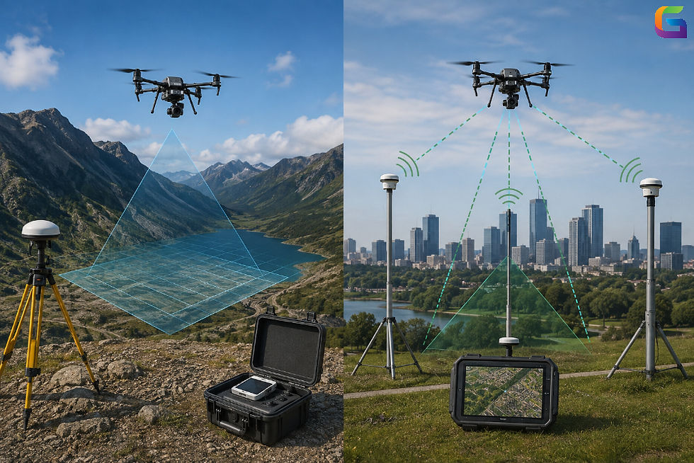
What Is RTK for Drones?
Real-Time Kinematic (RTK) is an advanced technique that is used in GNSS to provide correction data to a drone as it operates. There is a communication system between a drone's GNSS and a base station or correction network that ensures precise positioning.
For a standard RTK drone, one would use:
High-accuracy GNSS receiver
Base station or Continuously Operating Reference Station (CORS)
Transmission system for correction data
Observations from satellites of GPS, Galileo, GLONASS, and other GNSS
The base station computes corrections based on the differences between the known coordinates and the position received from the GNSS. Then, the corrections are sent to the drone, ensuring more precise recording of camera positions during the flight.
RTK technique proves efficient in cases when there is a need for immediate results and a reduction of the number of ground control points for a map.
What Is PPK for Drones?
Post Processed Kinematic (PPK) refers to a GNSS correction methodology whereby the position data is captured during the drone flight and then post-processed once the mission has been completed.
Contrary to other correction methods, which require a live correction signal, with the PPK method the drone captures the raw GNSS observations during flight. The base station, or reference station, similarly captures GNSS data during the drone flight. This is followed by processing of the data using specialized software to determine the more accurate drone positions.
The typical PPK process is as follows:
Recording GNSS data on the drone during the flight
Capturing base station data
Aligning rover and base GNSS data
Processing satellite data after the flight
Determining camera positions
Importing the determined positions in photogrammetric or LiDAR processing software
Since corrections are done after the mission, the PPK method does not need a live connection between the two ends.
PPK vs RTK: The Main Difference
However, the biggest disparity between these two techniques is when GNSS corrections are made.
For example, when using RTK, the corrections will be made and transmitted to the drone in real time when it is still airborne.
When it comes to PPK, the raw GNSS observations are collected during the mission and then corrected after the drone lands.
The effects of this disparity include the following:
PPK vs RTK Comparison Table
Feature | PPK | RTK |
Correction timing | After the flight | During the flight |
Internet requirement | Usually not required during flight | May be required when using network corrections |
Radio connection | Not continuously required | Often required |
Communication interruptions | Usually less problematic | Can affect real-time correction availability |
Field workflow | Additional post-processing required | Faster positioning workflow |
Camera geotagging | Corrected after flight | Corrected in real time |
Operational flexibility | High | Dependent on correction connectivity |
Immediate accuracy information | No | Yes |
Best for remote locations | Often highly suitable | May be challenging without a base station |
Processing requirements | Higher | Lower for GNSS correction processing |
How RTK Drone Mapping Works
In the RTK drone application, the drone is considered a mobile GNSS rover that not only receives signals from GNSS satellites but also receives correction data from the base station or GNSS correction networks.
The general process flow can be explained in this sequence:
Set Up a Reference Station
The base station is set up at an accurately determined location. Alternatively, the drone can use the CORS or Network RTK service.
Receive GNSS Signals
Both the drone and reference station observe signals from multiple GNSS satellites.
Compute Corrections
Based on the comparison between the known location of the reference station and the satellite’s location, positioning errors are computed.
Send Corrections
Correction data is sent to the drone via a radio, cellular, or any other type of link.
Log Corrected Positions
Corrected positions are logged by the drone.
How PPK Drone Mapping Works
PPK operates on the same principle as GNSS, but it processes the correction data after the mission.
Record Raw GNSS Data
GNSS observations of the drone during the flight are recorded.
Gather Reference Data
Either a local base station or a reference station will gather GNSS observations during the same time frame.
Synchronize Data
GNSS observations from the drone will be synchronized with the reference station.
Post Processing
Software that runs the PPK process will analyze GNSS observations and will determine corrections to the drone position.
Apply Camera or Sensors' Position Correction
Corrections are applied to camera pictures and LiDAR scans or other sensors' positions.
Process Mapping Dataset
Correction data will be used in photogrammetry or geospatial processing software to create mapping products.
Accuracy: Is PPK More Accurate Than RTK?
Both PPK and RTK can deliver very precise location services when correctly configured and used. In optimal conditions, both types of technology can deliver centimeter-accurate positioning for drone mapping purposes.
Yet, the accuracy of the positioning achieved by a drone depends on many factors, such as:
Visibility of GNSS satellites
Multipath effects
Distance from the base station
Quality of GNSS receivers
Antennas setup
Flight height
Camera/sensor calibration
Overlap of images
Terrain conditions
Processing photogrammetry
Ground control points and checkpoints
The operational superiority of PPK lies in the fact that GNSS data can be processed after the flight with the use of all data available. The processing software will be able to find a way to eliminate any problems with the data quality.
RTK provides immediate positioning correction and can deliver excellent results if the correction link does not go down.
Professional workflows of surveyors always include the use of independent checkpoints to assess the accuracy of the result, regardless of the type of technology used.
Advantages of RTK for Drones
There are many benefits provided by RTK in drone mapping and surveying.
Instantaneous Position Correction
RTK provides corrections in-flight and therefore positioning data becomes instantly available.
Shortened Field-to-Processing Workflow
Because the corrections are applied on the go, the amount of post-processing of GNSS data following flight could be minimized.
Reduction of Ground Control
RTK helps to cut the use of numerous ground control points if everything is set up right.
Suitable for Repeat Surveys
RTK will be helpful in the case of construction monitoring and other projects where repeat surveys are needed.
Instant Status Reporting
The status of RTK correction service can be tracked in-flight, and possible GNSS communications issues can be found out even before returning from the field.
Advantages of PPK for Drones
PPK also comes with several notable benefits.
No Continuous Correction Connection Needed
The PPK technique is not reliant on a steady real-time correction connection during the entire process.
Suitable for Distant Locations
This technique may be very efficient when applied in places where there is poor cellular or radio communication.
Data Processing Flexibility
All the GNSS information can be processed post-flight, enabling corrections to be computed based on all the gathered data.
Increased Resistance to Communication Failures
Short communication interruptions that may happen during the flight will have much less effect than they would in the case of the full real-time correction process.
Potential Efficiency of Field Work
Surveying teams do not need to worry about maintaining a real-time correction connection.
Disadvantages of RTK
Although RTK has several strengths, there are a few weaknesses as well.
Dependence on Correction Signal
Continuous connection to the base station or correction network is needed to ensure real-time corrections.
Network and Connectivity Limitations
There might be cases where cell or internet-based RTK services cannot be used.
Radio Range Limitations
When a local base station is used, there can be issues of interference due to terrain, obstructions, and distance.
Increased Complexity of Real-Time Setup
Setting up an RTK process involves a lot of steps that include setting up the base station, correction network, communication network, and the drone receiver.
Limitations of Post-Processed Kinematics (PPK)
PPK has a few limitations of its own.
Processing Time
The collected GNSS observations need to be processed after the mission.
Requirements of Data Management
It is crucial to collect, synchronize, and process GNSS observations.
No Corrected Position Instantly
It takes time before the corrected positions are available.
Processing Workflow Requirement
PPK involves a certain workflow for processing GNSS observations.
PPK vs RTK for Drone Photogrammetry
Both RTK and PPK can increase the accuracy of drone photogrammetry by improving the accuracy of the camera location.
Traditionally, drone mapping uses a lot of ground control points to improve the accuracy of georeferencing. RTK and PPK solutions offer very accurate camera location data, which allows for the reduction in the number of required ground control points.
But less reliance on ground control does not mean a lack of quality control.
For professional surveys, it is recommended to use independent checkpoints to assess the accuracy of the final product – orthomosaic, DSM, DTM, 3D model.
The workflow may be as follows:
Drone mission planning
Reference GNSS data collection
Flying the drone mission with necessary image overlap
RTK/PPK position data processing
Using accurate camera location data
Photogrammetry product generation
Independent checkpoints comparison
PPK vs RTK for Drone LiDAR
The decision regarding whether to use PPK or RTK also becomes critical for LiDAR drones.
LiDAR sensors depend on precise location and orientation of laser measurements that are then positioned correctly on the map. The LiDAR pipeline could involve such steps as:
GNSS location
Inertial Measurement Unit (IMU) data
LiDAR ranging
Trajectory calculation
Georeferencing point cloud
PPK technology is typically used in aerial and drone LiDAR surveying because the trajectory can be computed post-flight based on highly accurate GNSS and IMU data.
RTK can provide the accuracy necessary for LiDAR surveys provided that corrections can be supplied in real time.
For highly accurate missions, the entire GNSS/IMU trajectory must be carefully calculated and checked.
PPK vs RTK: Which Is Better for Drones?
PPK and RTK do not have one clear winner.
When real-time corrections are needed along with rapid workflow and communication, RTK is better.
On the other hand, if flexible operation, remote work, and GNSS post-processing are more important, PPK would be a good solution.
However, both techniques can provide very accurate results under appropriate conditions. It all depends on the location, communication system, sensors' setup, etc.
Both PPK and RTK have revolutionized drone surveying and mapping because of improved precision of drone positioning and less dependency on extensive ground control. RTK provides real-time corrections, which makes it highly relevant when rapid and effective fieldwork is needed. As for PPK, GNSS observations are processed after completing the flight; it is quite flexible and has less dependency on communication.
Both PPK and RTK can be applied to drone photogrammetry, LiDAR mapping, construction monitoring, mining, agriculture, infrastructure inspection, and topographic surveying.
The main thing is to use the workflow that fits your environment and needs. Whatever technology you choose, good base station data, appropriate mission planning, high-quality GNSS observations, and independent checks will always be important to achieve reliable geospatial results.
Knowing about PPK vs RTK for drones, mapping specialists will be able to choose the proper technology for their workflows.
For more information or any PPK and RTK questions, please don't hesitate to contact us at:
Email:
USA (HQ): (720) 702–4849


Comments