
Digital Terrain Models (DTMs) in GIS & Remote Sensing

Updated: Aug 20
Digital Terrain Models (DTMs) are one of the most useful data sets in Geographic Information Systems (GIS) and remote sensing. DTMs provide the fundamental data required to understand the terrain on Earth, from assessing the risk of flooding and planning for infrastructure to performing hydrologic modeling and analyzing landforms.
As more sources of high-resolution elevation data become available, such as LiDAR, photogrammetry, drones, and satellite images, DTMs have become critical to professionals such as engineers, GIS analysts, environmental scientists, and urban planners.
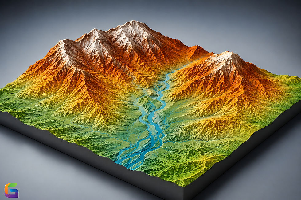
What Is a Digital Terrain Model (DTM)?
A DTM, or Digital Terrain Model, is a digital model of the bare earth surface. This is different from elevation models that include above-ground objects such as buildings, trees, and other such features. A DTM consists purely of elevation data after these elements have been stripped off.
A DTM contains elevation data in raster format or triangulated irregular networks. DTMs are useful for analyzing the terrain.
The most important features of DTMs include:
Represents the bare earth without vegetation or man-made structures
Assists in making necessary calculations
Great for performing spatial and hydrological analyses
Why Are DTMs Important?
The terrain has a significant impact on most environmental and engineering processes.
An effective DTM allows practitioners:
To predict the flow of water
To compute the slope and aspect
To detect watersheds
To design highways and railways
To prepare for urban planning
To assess erosion issues
To modernize precision agriculture
To facilitate the management of catastrophes
In the absence of proper terrain data, some analyses may yield wrong conclusions.
How Is a Digital Terrain Model Created?
Making a DTM includes two stages:
Data Collection
LiDAR (Light Detection and Ranging)
Drones
Ground surveys with GPS
Ground Point Classification
The raw dataset concerning the elevation describes:
Trees
Buildings
Bridges
Cars
Plants
The algorithm classifies points as those belonging to the ground and those that do not.
Creation of Terrain Surface
Points on the terrain are converted into an interpolated surface based on methods such as:
IDW
Kriging
Natural Neighbor
Spline interpolation
TIN
Assessment of Quality
Quality of the created terrain model is verified through:
Control points
Survey benchmarks
Rightness assessments
RMSE
DTM vs DEM vs DSM
These elevation models are often confused.
Feature | DTM | DEM | DSM |
Represents bare ground | Yes | Usually | No |
Includes buildings | No | Usually No | Yes |
Includes vegetation | No | Usually No | Yes |
Terrain analysis | Excellent | Excellent | Limited |
Urban modeling | Limited | Limited | Excellent |
Hydrological analysis | Excellent | Good | Poor |
Understanding the distinction helps users select the appropriate dataset for specific GIS projects.
Different Sources of Digital Terrain Model Data
Various institutions offer free digital terrain data.
Some well-known sources are:
USGS 3DEP
NASA SRTM
Copernicus DEM
LiDAR Surveys
National Mapping Authorities
Private Satellite Companies
Applications of Digital Terrain Models
Hydrological Studies
Digital Terrain Models make it possible to:
Map the watershed
Obtain the drainage network.
Conduct floodplain mapping
Perform stream network analysis.
Model surface runoff
Knowing the terrain is vital for hydrologists who need to predict the water flow.
Building Infrastructure
The use of Digital Terrain Models is important for civil engineers to:
Design highways
Plan railways
Build pipelines
Construct canals
Find the best route for utilities.
Knowledge of terrain helps to avoid unnecessary expenses and also helps to minimize ecological impact.
Urban Development
Digital Terrain Models help urban planners to:
Conduct site suitability analysis
Plan new developments
Plan stormwater management
Grade the terrain
Design smart city solutions.
Environmental Management
Environmental science includes analysis of:
Soil erosion
Landslide susceptibility
Habitat suitability
Wetland mapping
Conservation planning
Agriculture
Precision agriculture takes advantage of DTM through:
Irrigation planning
Drainage analysis
Soil moisture estimation
Land leveling
Crop suitability analysis
Mining
Mining companies utilize DTM in the following areas:
Volume estimates
Open-pit mining monitoring
Construction of haul roads
Slope stability analysis
Advantages of Digital Terrain Models
There are many advantages of DTM;
Terrain has great accuracy.
Highly efficient for spatial analysis
The design process of engineering gets better.
Enhances hydrological modeling
Terrain processing may become automatic.
Works well with most of the GIS tools
Significant for ecological research
Supports 3D visual appearance of the terrain
DTMs Drawbacks
But there are limitations of DTMs as well.
Data Quality
Bad data in terms of quality ruins the accuracy of models.
Low resolution restrictions
Models with low resolution may lack some of the smaller features of the terrain.
Processing Requirements
LiDAR data requires the use of extensive computing power.
Cost
Conducting terrain surveys may turn out very expensive.
Interpolation Errors
Interpolation techniques may cause high exposure to errors if there is not enough data.
Famous GIS Programs for the Modeling of DTMs
One can mention such tools as:
ArcGIS Pro
GRASS GIS
Global Mapper
SAGA GIS
WhiteboxTools
Every tool has its own unique set of tools for terrain visualization, hydrological modeling, slope computation, and contour line generation coming along with them.
The Future of Digital Terrain Modeling
Technological development of geospatial technologies has significantly improved terrain modeling.
Recent advancements in DTM modeling include:
AI-based classification of the terrain
The use of machine learning algorithms for feature detection
The use of drones for terrain modeling at a higher resolution
Cloud computing for GIS processing
Real-time situation updates
Development of smart models
The use of improved versions of LiDAR sensors
The modeling of DTMs by means of various data sources.
Digital Terrain Models play an essential role in GIS and remote-sensing processes. Digital Terrain Models provide information about the bare earth, which is useful in various applications, especially hydrography, construction of infrastructure, environmental management, agriculture, mining, and risk management of disasters.
Knowing how these models are developed, their differences from Digital Elevation Models (DEM) and Digital Surface Models (DSM), and knowing when to use the models are very important in GIS tasks. With modern technologies such as LiDAR, drones, and artificial intelligence, Digital Terrain Models will gain more importance in geospatial analysis.
For more information or any questions regarding Digital Terrain Models (DTMs), please don't hesitate to contact us at:
Email:
USA (HQ): (720) 702–4849


Comments