
How to get a Current Aerial View of my Property?
- Anvita Shrivastava

- Sep 2, 2025
- 3 min read
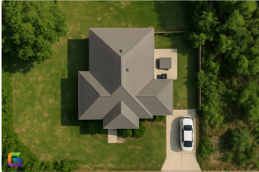
Obtaining a current aerial image of your property is now simpler, quicker, and cheaper than ever, thanks to the development of reasonably priced drone technology. Drones offer high-resolution aerial imagery whenever you need it, whether you're a farmer evaluating crop health, a real estate agent producing marketing images, or a homeowner tracking property developments.
Why Use Drones for Aerial Property Views?
Drones offer near-real-time, on-demand aerial photography, in contrast to antiquated satellite photos or costly helicopter assessments. Important advantages include:
Current imagery – Take note of the condition of your land, buildings, and surroundings right now.
High-resolution detail: Contemporary drones produce high-megapixel photos and 4K+ video.
Flexibility: For unique perspectives, fly at various elevations and angles.
Cost-effectiveness: Compared to conventional aerial surveys, one-time drone flights are less expensive.
Geospatial accuracy: A lot of drones have mapping and GPS capabilities for measuring properties.
Step-by-Step Guide to Capturing a Current Aerial View of Your Property
Choose the Right Drone
Depending on your imaging requirements, choose a drone:
Drones for beginners (Autel Evo Nano, DJI Mini series) for basic overhead photography.
For high-resolution aerial mapping, use professional drones (DJI Air, Mavic 3, Phantom 4 RTK).
Drones for mapping and agriculture (DJI Matrice series, SensFly eBee) for accurate surveys.
Check Local Drone Regulations
Before taking off, make sure that:
Drone regulations from the FAA (U.S.), DGCA (India), or EASA (EU).
No-fly areas close to military installations, government buildings, and airports.
Pilot licensing and drone registration are mandatory.
Plan Your Flight Path
Utilize flight-planning software such as DroneDeploy, Pix4Dcapture, or DJI GS Pro to:
Determine the coverage area and flying altitude.
Set up automated aircraft routes to produce reliable images.
Make sure the landing and takeoff areas are secure.
Capture Aerial Photos and Videos
For precise property-level information, fly between 50 and 120 meters over the ground.
Take several pictures from various perspectives, such as panoramic, oblique, and top-down.
Take video flyovers to get a dynamic viewpoint.
Process and Analyze the Data
Depending on your goal:
Basic visualization: View photos with picture software or drone apps.
Pix4D, DroneDeploy, and Agisoft Metashape for orthomosaics and 3D models are used in the mapping and surveying process.
Edit using programs like Adobe Lightroom or Final Cut Pro for real estate marketing.
Applications of Aerial Property Views
Real estate: Use captivating aerial footage to highlight properties.
Construction: Keep an eye on boundary design and site developments.
Agriculture: Evaluate land condition, irrigation, and crop growth.
Landowners - Track vegetation, encroachments, or border changes.
Insurance and Inspections: Record the state of the property for evaluations or claims.
Safety and Best Practices
Make sure you can always see the drone.
Steer clear of flying in inclement weather or high winds.
When taking pictures, respect the privacy of your neighbors.
Before every flight, check the equipment and batteries.
Using drones to obtain a current aerial view of your property is no longer a difficult or expensive process. Accurate, high-resolution property photos can be taken whenever you need them with the correct gear, legal knowledge, and flight preparation. Drone aerial views provide experts and property owners with strong visual data for decision-making in a variety of fields, including agriculture and real estate.
For more information or any questions regarding aerial imagery, please don't hesitate to contact us at:
Email: info@geowgs84.com
USA (HQ): (720) 702–4849


Comments