
Drone mapping vs traditional surveying
- Anvita Shrivastava

- Apr 6
- 3 min read
As the geospatial industry continues to evolve at an astonishing pace, many professionals have begun to use advanced technologies to improve accuracy, efficiency, and cost-effectiveness. One of the most revolutionary technological advancements has been drone mapping. Drone mapping is changing the way that data is collected and analyzed. But how does drone mapping stack up against traditional surveying methods that have been used for many decades?
This technical guide will help provide more clarity into the differences between drone mapping and traditional surveying to allow you to make an informed decision on what will be the best solution for your project.

Defining Drone Mapping
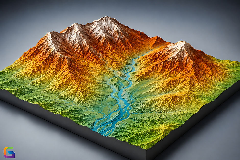
Drone mapping is the use of drones equipped with high-resolution cameras, LIDAR (Light Detection and Ranging), or multispectral imaging systems to capture aerial data from above. The data collected is then processed through photogrammetry software to produce:
Drone mapping can be utilized in a variety of industries such as construction, agriculture, mining, and infrastructure inspection.
What is Traditional Surveying?
Traditional surveying capitalizes on land-based equipment and manual techniques to measure distance, angles, and elevation. The tools used for traditional surveying are:
Total Stations
Theodolites
GPS/GNSS Receivers
Levels & Rods
The surveyor physically visits the project site and collects the data one point at a time to generate maps and plans.
Key Differences Between Drone Mapping and Traditional Surveying
The key points of difference between Drone Mapping Services and Traditional Surveying Services include:
Accuracy / Precision
Traditional Surveying can produce millimeter-level accuracy, depending on how well it is performed, and is the preferred method for legal boundaries and method of engineering-grade measurements.
Drone Mapping Systems with Ground Control Points (GDC) and Real-Time Kinematic / Post Processed Kinematic (RTK/PPK) systems can achieve centimeter-level accuracy if properly used. This level of accuracy is generally acceptable for most major mapping projects.
Speed / Efficiency
Drone Mapping can fly over numerous acres in a single day and obtain thousands of data points without human input.
Traditional Surveying is very time-consuming for large/complex areas and relies on manual data collection and processing.
Cost Effectiveness
Drone Mapping requires much less labor, has less time spent in the field, and requires little setup for equipment. Drone Mapping is, therefore, the most cost-effective option for mapping large areas.
Traditional Surveying requires skilled workers, much more time in the field, and can often have a greater operational cost.
Safety
Drone Mapping
Allows for collecting data in locations that are hazardous or difficult to access, such as cliffs, mines, highways, and construction sites, without having to send someone into danger.
Traditional Surveying
Requires the use of people and requires them to go into dangerous areas to collect data.
Data Density and Visualization
Drone Mapping
Provides millions of data points (very dense data), which are able to create 3D models and very detailed visualizations.
Traditional Surveying
Uses fewer data points, which focus on specific locations.
Accessibility and Terrain Adaptability
Drone Mapping
Allows for easy access to remote and rough terrains with no constraints by using traditional means.
Traditional Surveying
Using traditional methods on difficult terrain can be very challenging (or impossible).
When to Use Drone Mapping
Ideal for:
Large land survey
Monitoring the progress of construction
Analyzing mining and quarry sites
Mapping agricultural fields
Inspecting infrastructure
When to Use Traditional Surveying
Better suited for:
Boundary survey
Projects that require high accuracy for engineering
Urban areas that are subject to stricter regulations
Projects that require certified surveying data
Both drone mapping and traditional surveying offer benefits; however, the type of project you are working on can determine which is right for you. Regardless of your project, traditional surveying is still paramount for high-precision locations (e.g., for legal purposes) while drone mapping has drastically changed how surveyors conduct business due to its speed, level of safety, and data gathering ability.
With the ongoing development of UAV technology, any business that implements this type of mapping method is likely to achieve greater accuracy, improved efficiency, and ultimately save money over those who don't use similar methods to collect spatial data.
For more information or any questions regarding the drone mapping, please don't hesitate to contact us at:
Email:
USA (HQ): (720) 702–4849


Comments