
From Drone to Decision: Turning Drone Data into Actionable Insights
- Anvita Shrivastava

- Feb 13
- 4 min read
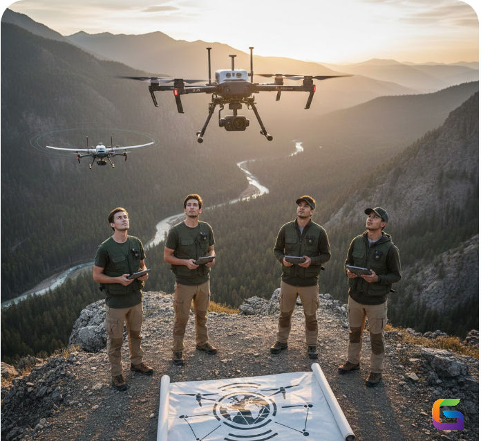
Drones are more than simply flying cameras. Drones have become sophisticated data collection devices with the capability to totally change the way industries operate across multiple sectors, including building projects, agriculture, utilities, and emergency management/response efforts. These UAVs are collecting large amounts of geospatial information about our environment from various perspectives.
However, simply having raw drone footage does not create value. The greatest value from the collection of drone data will occur when that data is transformed into actionable insights. This technical document will provide an overview of how to convert drone data into intelligent decision-making, as well as help organisations develop scalable, data-driven workflows.
Why Drone Data Is a Strategic Asset
Modern UAVs utilizing advanced sensor technology can capture:
High-quality RGB imagery
Multispectral and hyperspectral data
Thermal imagery
LiDAR point clouds
3D photogrammetric models
Vendors such as DJI, Skydio, and senseFly manufacture enterprise-grade UAV systems with centimeter-level accuracy; however, without structured post-processing or geospatial analytics applied to the data, the competitive advantage lies in converting aerial data into operational intelligence.
The Drone-to-Decision Workflow
In order to turn drone imagery into actionable insights, you must follow a structured pipeline. The following framework has been used successfully across multiple industries:
Mission Planning and Data Acquisition
The first step is mission planning through strategic flight paths.
Key things to consider are:
Altitude of flight and overlap with other flights
Sensor calibration
Weather conditions at the time of flight
Compliance with FAA Regulations (Part 107) in the U.S
You must collect accurate data for your outputs to be reliable down the line. If you collect inaccurate data, then the models you create will not be reliable, regardless of whether or not you have advanced software technology.
Processing and Photogrammetry of Data Collected
Once your drone has collected images, those images need to be processed via photogrammetry into usable geospatial outputs.
These software programs are capable of taking your raw photographs and converting them into the following usable geospatial outputs:
Orthomsaics
3D Meshes
Point Clouds
Depending on both the volume of data you have collected and the amount of resources required to process it, you can choose either Cloud Processing or Local Processing to process your images into usable data outputs.
Analysis and extraction of intelligence from data.
Drone data can provide new insights and opportunities.
Advanced analytics allows the extraction of:
Volumetric measurements/assessments (i.e., amount of material stockpiled or amount of work done on excavating).
Crop health metrics (i.e., NDVI and NDRE).
Identification of structural defects and/or thermal anomalies.
Vegetative encroachment onto utility infrastructure.
Changes over time.
Use of artificial intelligence (AI) and machine learning (ML) algorithms to assist in analysis processes increases the number and quality of the data that can be used for further predictive evaluations and automated defect detection.
Integration of Data with GIS/Enterprise Systems.
Drone data should not exist as stand alone entity.
When integrated into existing GIS platforms (i.e., ArcGIS) and/or CAD/BIM environments, teams can better utilize aerial-based intelligence associated with their already existing infrastructure.
Enterprise integrations yield:
Real-time dashboards.
Updating of asset management.
Automation of workflow processes.
Predictive modelling of various types of data.
Lastly, this is at the point where insights lead to the operational decisions that you make.
Industry Applications: Real-World Decision Making
Construction - Infrastructure
Evaluate progress against the BIM models.
Earthwork volume verification
Safety compliance monitoring
Optimize site logistics
Analytics from drones will reduce rework, enhance the project timeline, and provide greater transparency for all stakeholders.
Multispectral drone data used for precision agriculture includes:
Identifying nutrient deficiencies
Identifying irrigation issues
Identifying crop stress
Optimizing the use of fertilizer
With data, farmers can make informed decisions to drive down their costs and increase yield.
UAVs equipped with thermal imaging and LiDAR are being used to inspect:
Solar panels
Monitor power lines
Surveillance for pipelines
Assess wind turbine blades.
Proactive maintenance lowers the downtime of assets and increases their lifespan.
Emergency Response and Disaster Management
Rapid WWIR (worldwide Integrated Roughness) aerial mapping supports:
Damage Assessment
Search & Rescue Coordination
Flood Modelling
Wildfire Perimeter Tracking
Decision-Makers Have Increased Real-Time Situational Awareness in Critical Situations.
Key Challenges in Turning Drone Data into Insights
Data Overload---High resolution Drone missions produce a great deal of data, resulting in enormous data sets that are beyond the capabilities of traditional storage devices and analytical solutions.
Skill Gaps---In order to be successful in any organization, employees must possess multidisciplinary skills: data science, geographical information systems, UAV operations, etc.
Standardization Issues---The problem with standardization is that without a defined standard workflow, there is an opportunity for employees to produce different results.
Cyber Security and Data Governance---Drone data often contains information about critical infrastructure, so it is necessary to properly control access and encrypt the data.
Drones are powerful tools—but data is the real asset.
The transition from capturing aerial imagery to making informed operational decisions requires structured workflows, advanced analytics, and system integration.
Businesses that master the drone-to-decision pipeline will reduce costs, increase efficiency, and gain a strategic advantage in data-driven operations.
At UAVSphere, we focus on bridging the gap between UAV technology and real-world implementation—helping organizations unlock the full potential of drone data.
For more information or any questions regarding the drone data, please don't hesitate to contact us at:
Email:
USA (HQ): (720) 702–4849


Comments