
Drone Imaging: Transforming Aerial Data Collection and Mapping
- Anvita Shrivastava

- Mar 16
- 4 min read
The application of drone image collection has rapidly transformed from a niche type of technology to being an essential piece of equipment for many industries needing highly accurate and high-quality (i.e., high-resolution) spatial data. Examples include construction, agriculture, environmental monitoring, and inspection of existing infrastructure. Advanced imaging sensors aboard UAVs are changing the way in which aerial data is captured, analyzed, and ultimately used to make decisions.

What is Drone Imaging?
Drone imaging is the capturing of aerial images, videos, and geospatial data using cameras and other sensors mounted to UAVs. Unlike traditional aerial photography and surveying conducted by using manned aircraft and satellites, UAVs fly at much lower altitudes, create ultra-high resolution images, and capture data on a more frequent basis and at a much lower cost.
Most drone imaging systems utilize the following components:
High-resolution RGB cameras
Multispectral/hyperspectral sensors
Thermal imaging cameras
LiDAR scanners
GPS/RTK-based positioning systems
The capabilities of these various types of technologies on UAVs enable the creation of very detailed datasets for mapping, modeling, surveying, and analytics.
How does drone imaging work?
Drone imaging consists of a multiple-step process for creating types of geo-spatial data with images taken from drones.
Planning the flight.
Before starting the drone flight, a flight plan is created with the use of special flight planning software, which provides the following information for the flight:
The altitude of the flight.
The amount of image overlap is 70-80%.
The overall area to be flown.
Waypoints and flight path of the drone.
Good planning allows the images captured during the flight to be stitched together correctly in the end.
Capturing the images.
While flying the drone, the drone autonomously takes a series of geotagged photographs. Because of the high overlap, there are many images that will provide common points for the software to find the matching points from photo to photo.
Based on the requirements of the specific mission, the following types of imagery can be obtained:
Visible light imagery.
Thermal imagery.
Vegetation health data.
Elevation.
Photo processing.
Once the images are obtained, they are processed by photogrammetric software. The output of the photogrammetric software will provide several outputs, including (but not limited to):
Orthomosaic Maps
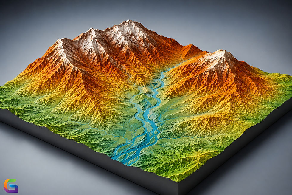
3D Digital Terrain Models
Point Cloud
The outputs of these products will provide a very accurate representation and a measure of the area surveyed.
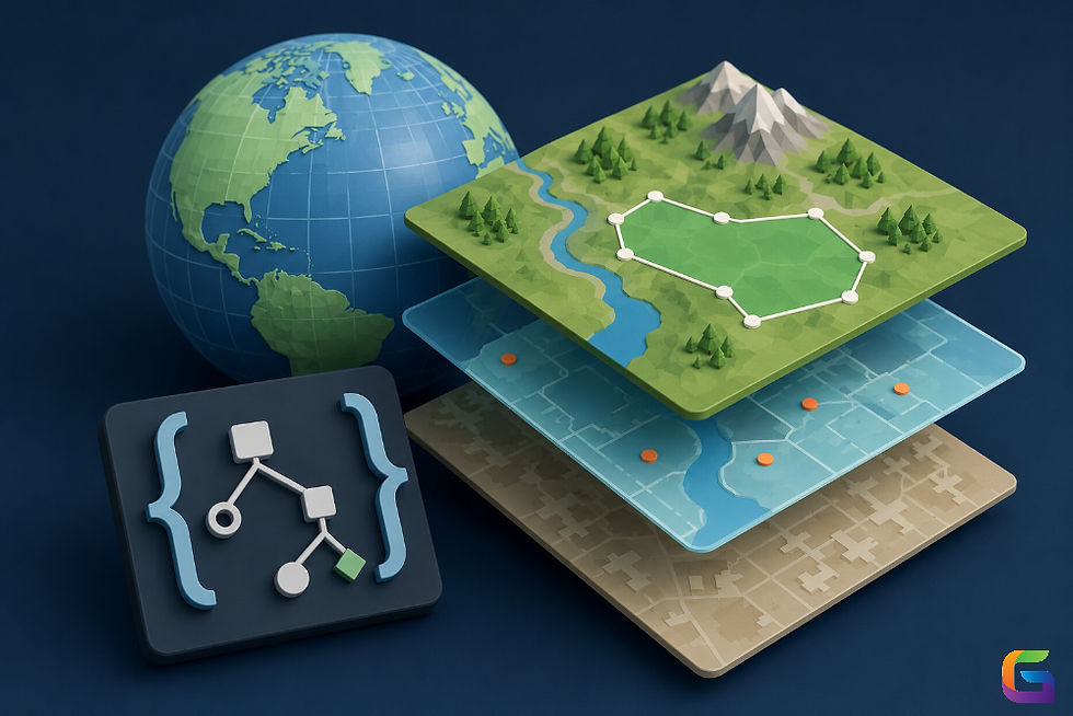
Data Analysis and Visualization
GIS platforms or specialized analytics software can be utilized to analyze processed data and develop insights for planning, monitoring, and decision support.
Key Technologies Driving Drone Imaging
Drone imaging has been enabled by hardware and software technological advances.
High-Resolution Sensors
Camera systems mounted on drones are capable of capturing images up to 20-100+ megapixels, allowing for very high-quality aerial mapping.
RTK and PPK GPS
Real-Time Kinematic (RTK) and Post-Processed Kinematic (PPK) positioning technologies give the ability to geolocate images with centimeter-level accuracy without requiring ground control points.
LiDAR Fusion
LiDAR uses laser beams to measure distances and to develop accurate 3D point clouds, even in places with heavy foliage.
Artificial Intelligence & Machine Learning
AI and ML can automate the detection and classification, and detection of changes to objects in the image data from the drone.
Advantages of Drone Imaging Over Traditional Methods
Compared to traditional methods of aerial survey, drone imaging provides numerous benefits.
Cost Savings
Conducting a drone mission costs many times less than conducting a manned aircraft or business that provides satellite images.
Resolution
Drone images taken at low altitudes provide centimeter-resolution imagery. This resolution is far greater than most satellite data.
Time to Collect Data
Surveys performed using drones can be set up quickly and provide data in hours as opposed to days or weeks.
Increased Safety
Drones are able to perform inspections of hazardous or hard-to-reach locations, such as rooftops, cliffs, or industrial facilities, without risking personnel.
Frequent Monitoring
Organizations can perform periodic surveys to document changes over time and keep their data up-to-date.
Challenges in Drone Imaging
Although drone imaging has many benefits, there are also several challenges associated with this type of imaging.
Regulatory Limitations
All drone operations must comply with governing bodies' aviation regulations, which include restrictions on airspace and regulations governing the certification of a pilot flying the drone.
Reliability of Weather Conditions
The wind, rain, and lack of sufficient light can all cause issues in the safety of flight and the quality of images taken from a drone.
Resources Required to Evaluate and Process Data
The amount of data created by high-resolution aerial imagery requires the use of many high-powered computers and the use of software that is specifically designed to evaluate and process this amount of data.
Requirement for Trained Drone Professionals
In order for drone imaging to be effective, the profession within the image must be able to plan the flight of the drone, calibrate the sensors, and process all of the data that is collected from the imaging of the aerial photography.
Future of Drone Imaging
Drones are consistently innovating within the drone imaging sector. Emerging trends that are developing are the use of:
Autonomous drone fleets to conduct large area mapping projects.
Real-time aerial analytics powered by edge computing.
Automated inspections of imagery via the use of artificial intelligence to interpret images.
Integrating the drone imaging process with digital twins and smart cities.
As sensors improve and regulations become more mature, drone imaging will continue to be critical to improving geospatial intelligence, managing our infrastructure, and protecting the environment.
The arrival of drone imaging has brought about a radical change in the collection of aerial data, providing high-resolution geospatial data promptly at a low cost and with unprecedented accessibility. Both advanced sensors and accurate navigation systems, coupled with sophisticated analytics software, are aiding organizations in their ability to monitor, map, and manage the world at an exceptional level of accuracy through UAVs.
Drone imaging has now transitioned from being a developing technology to a necessity for many businesses that need to find a better and more efficient means to collect aerial data, and has become a fundamental element of the contemporary geospatial workflow.
For more information or any questions regarding the drone imaging, please don't hesitate to contact us at:
Email:
USA (HQ): (720) 702–4849

Comments