
Does UAVSphere Support Utility and Power Line Inspections?
Yes, UAVSphere supports utility and powerline inspection services by connecting businesses with experienced drone pilots and aerial data professionals. Drone-based inspections provide a safer, faster, and more cost-effective alternative to traditional ground surveys and manual inspections, especially for large-scale electrical infrastructure.
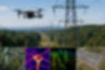
With UAVSphere, utility companies can access drone services for powerline corridor mapping, transmission tower inspections, substation assessments, vegetation monitoring, and infrastructure condition analysis. High-resolution RGB cameras, thermal sensors, and LiDAR technology can capture detailed data to identify potential issues such as damaged components, overheating equipment, encroaching vegetation, structural defects, and maintenance requirements.
Drone inspections help reduce risks for field crews by minimizing the need for climbing towers or working in hazardous environments. The collected imagery and geospatial data can be processed into accurate deliverables, including orthomosaics, 3D models, point clouds, thermal maps, and inspection reports.
UAVSphere’s network of qualified drone professionals enables utility providers, energy companies, and infrastructure managers to efficiently monitor assets, improve maintenance planning, and make data-driven decisions using advanced aerial inspection solutions.
For more information or any questions, please don't hesitate to contact us at:
Email:
USA (HQ): (720) 702–4849