
The 3D Models
Photogrammetry is a widely used technique for generating precise 3D models from drone-captured imagery. It works by taking multiple overlapping aerial photographs of an area from different angles. Specialized software then analyzes these images to detect shared reference points across them. By matching these common points, the system calculates spatial relationships and reconstructs the scene in three dimensions.
The result is a highly accurate digital 3D representation of real-world environments such as buildings, roads, terrain, and industrial infrastructure. This method is extensively used in surveying, construction, mapping, and inspection because it can quickly produce detailed and realistic models without direct physical measurement, improving efficiency and accuracy in data collection and analysis.
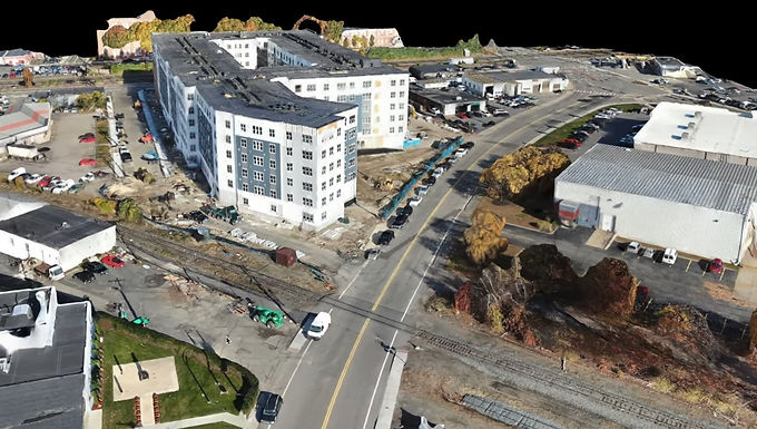
The resulting 3D models provide spatial insights for planning, design, inspection, and analysis across industries. Users can visualize structures, terrain, and landscapes in high detail from multiple perspectives, improving understanding of site conditions and relationships. The models enable accurate measurement of distances, areas, volumes, and dimensions, supporting better decisions and reducing field visits. They can be integrated into engineering, construction, mining, agriculture, and environmental workflows for progress tracking, asset management, and risk assessment. Using drone data capture with advanced photogrammetry, organizations generate accurate, up-to-date 3D representations of real environments. This approach improves efficiency, lowers costs, and enhances safety by reducing manual surveying in hazardous areas. Overall, 3D models form a strong digital foundation for visualization, planning, and analysis in modern industries.
For more information or any questions regarding our services, please don't hesitate to contact us at
Email: info@geowgs84.com
USA (HQ): (720) 702–4849
India: 9009471866 - Jay Sharma
Canada: (519) 590 9999
Mexico: 55 5941 3755
UK & Spain: +44 12358 56710