
Geospatial Drone Analytics
Geospatial Drone Analytics combines drone technology, GIS, remote sensing, and artificial intelligence to transform aerial data into valuable geospatial insights. By processing high-resolution drone imagery, LiDAR point clouds, multispectral data, and 3D mapping outputs, organizations can perform accurate mapping, monitoring, and analysis across industries. Geospatial drone analytics enables applications such as land surveying, agriculture monitoring, infrastructure inspection, construction progress tracking, environmental assessment, and disaster management. Advanced GIS workflows and AI-powered analytics help extract features, detect changes, measure assets, and generate actionable intelligence from drone data. With centimeter-level accuracy and faster data collection, geospatial drone analytics is becoming an essential solution for modern mapping, smart cities, precision agriculture, and digital twin development.
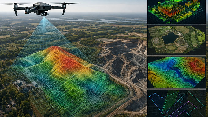
Geospatial Drone Analytics is an advanced approach that integrates UAV data, Geographic Information Systems (GIS), remote sensing, and AI-driven analytics to unlock deeper insights from aerial observations. Drones equipped with high-resolution cameras, LiDAR sensors, and multispectral systems capture detailed spatial data that can be converted into accurate maps, 3D models, digital elevation models (DEM), and actionable intelligence. This technology supports a wide range of applications, including precision agriculture, mining, urban planning, infrastructure management, environmental monitoring, and surveying. By enabling faster data acquisition, automated feature extraction, and real-time spatial analysis, geospatial drone analytics helps businesses and government organizations make data-driven decisions, improve operational efficiency, and manage assets with greater accuracy. It is a key technology driving the future of smart mapping, digital twins, and intelligent geospatial solutions.
For more information or any questions regarding our services, please don't hesitate to contact us at
Email: info@geowgs84.com
USA (HQ): (720) 702–4849
India: 9009471866 - Jay Sharma
Canada: (519) 590 9999
Mexico: 55 5941 3755
UK & Spain: +44 12358 56710