
DEM
A Digital Elevation Model (DEM) is a digital 3D representation of the Earth's surface that stores elevation values for each location. DEMs are created using data from satellites, aerial photography, drones, LiDAR, and ground surveys. In Geographic Information Systems (GIS), DEMs are used to analyze terrain, generate contour maps, and visualize landscapes. They support applications such as hydrology, environmental monitoring, agriculture, forestry, urban planning, transportation, disaster management, mining, and civil engineering. DEMs help calculate slope, aspect, hillshade, watersheds, drainage networks, visibility, and landforms, making them essential for flood modeling, infrastructure planning, erosion analysis, and natural resource management. By providing accurate elevation data, DEMs improve spatial analysis, mapping, and decision-making across scientific, engineering, and environmental projects.
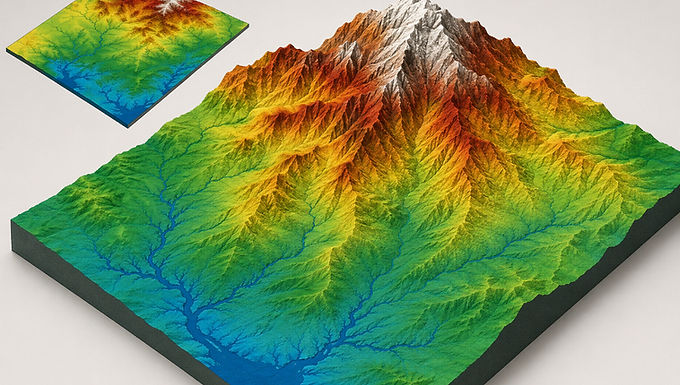
Digital Elevation Model (DEM) data represents the Earth's surface elevation and is widely used in GIS, remote sensing, and environmental analysis. It supports applications such as watershed management, flood risk assessment, terrain modeling, slope and aspect analysis, infrastructure planning, land-use management, and environmental monitoring. DEMs help researchers, engineers, planners, and decision-makers analyze terrain characteristics, identify drainage patterns, generate contour maps, evaluate construction sites, and create realistic 3D landscape visualizations. High-resolution DEMs improve the accuracy of spatial analysis, enabling better decisions for urban development, agriculture, natural resource management, disaster preparedness, and conservation. By providing detailed elevation information, DEM data plays a vital role in mapping, planning, and scientific research, making it an essential component of modern Geographic Information Systems (GIS) and geospatial applications.
For more information or any questions regarding our services, please don't hesitate to contact us at
Email: info@geowgs84.com
USA (HQ): (720) 702–4849
India: 9009471866 - Jay Sharma
Canada: (519) 590 9999
Mexico: 55 5941 3755
UK & Spain: +44 12358 56710